By Zachary Keith
This week, the Tennessee State Library & Archives surpassed 1,000 digitized maps in our
online map collection. Since the collection's launch in December 2014, a team of archivists and imaging specialists has curated, digitized, and added 1,006 maps online.
Check out some noteworthy maps from our extensive collection.
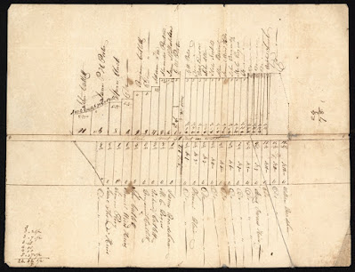 |
| The 1,000th map in our collection is this plat of Sevierville, possibly the oldest existing map of the town, drawn between 1818 and 1832. It denotes early lot owners and a Baptist church, most likely Forks of the River Baptist. See it online. |
 |
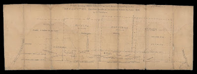
| Among our most recent additions is this map showing farms and landowners from the 1850s in the area that would largely become the Great Smoky Mountains National Park. You might recognize the Smokies landmarks such as Chimney Tops and Sugarland Mountain. See it online. |
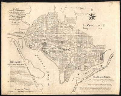 |
| While our collections naturally focus on Tennessee geography, our maps span the globe. One such gem is Andrew Ellicott’s original layout for Washington D. C., which he copied from Pierre L’Enfant’s plan. See it online. |
 |
| Among the first maps uploaded as part of the initial collection launch in December 2014 was this 1818 map of Tennessee by cartographer John Melish. See it online. |
 |
| Our maps represent each of Tennessee’s 95 counties and the state’s “lost counties,” like this one of Bell County, which was sued out of existence. See it online. For more on Bell County, see our blog post here. |
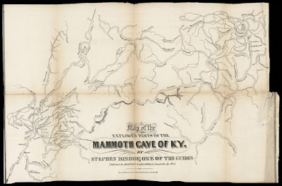 |
| This map of Mammoth Cave was drawn by formerly enslaved guide and explorer Stephen Bishop. See it online. |
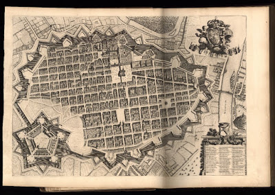 |
| Our oldest scanned map, published in 1700, is this representation of Turin that appeared in an atlas boasting the Duke of Savoy’s realm. See it online. |
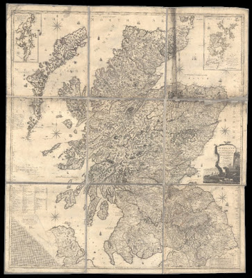 |
| Among our largest digitized maps is this massive view of Scotland drawn by Scottish cartographer John Ainslie in 1800. It is roughly 5.5 feet by 6 feet! See it online. |
 |
| We have the first map ever published of Tennessee as a state, drawn by Territorial Secretary Daniel Smith in 1795. See it online. |
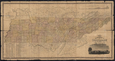 |
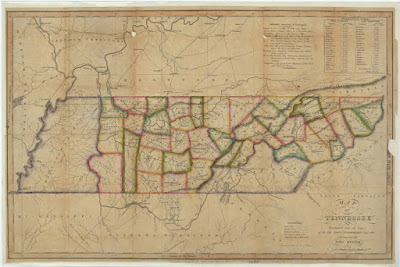
| This map drawn by Matthew Rhea in 1832 is the best overall map of Tennessee in the early national period. In addition, we have preserved the hand-drawn county-level maps he used to make his masterpiece. See it online. |
 |
| The Library & Archives holds the oldest existing map of Nashville’s city lots, drawn in 1789 by surveyor Thomas Molloy. See it online. |
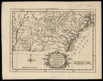 |
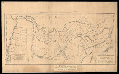
| This 1765 map identifies the Tennessee River as the “Hogoheegee,” an early Cherokee name for the waterway, and the Clinch River in East Tennessee as the “Pelisipi.” These Native names predate colonization in the area and demonstrate that the Cherokee still maintained dominance in the region. See it online. |
Please visit the
Tennessee Virtual Archive to see these and literally more than a thousand other maps. Newly digitized maps are added to the collection each month.
The Tennessee State Library & Archives is a division of the Office of Tennessee Secretary of State Tre Hargett.
